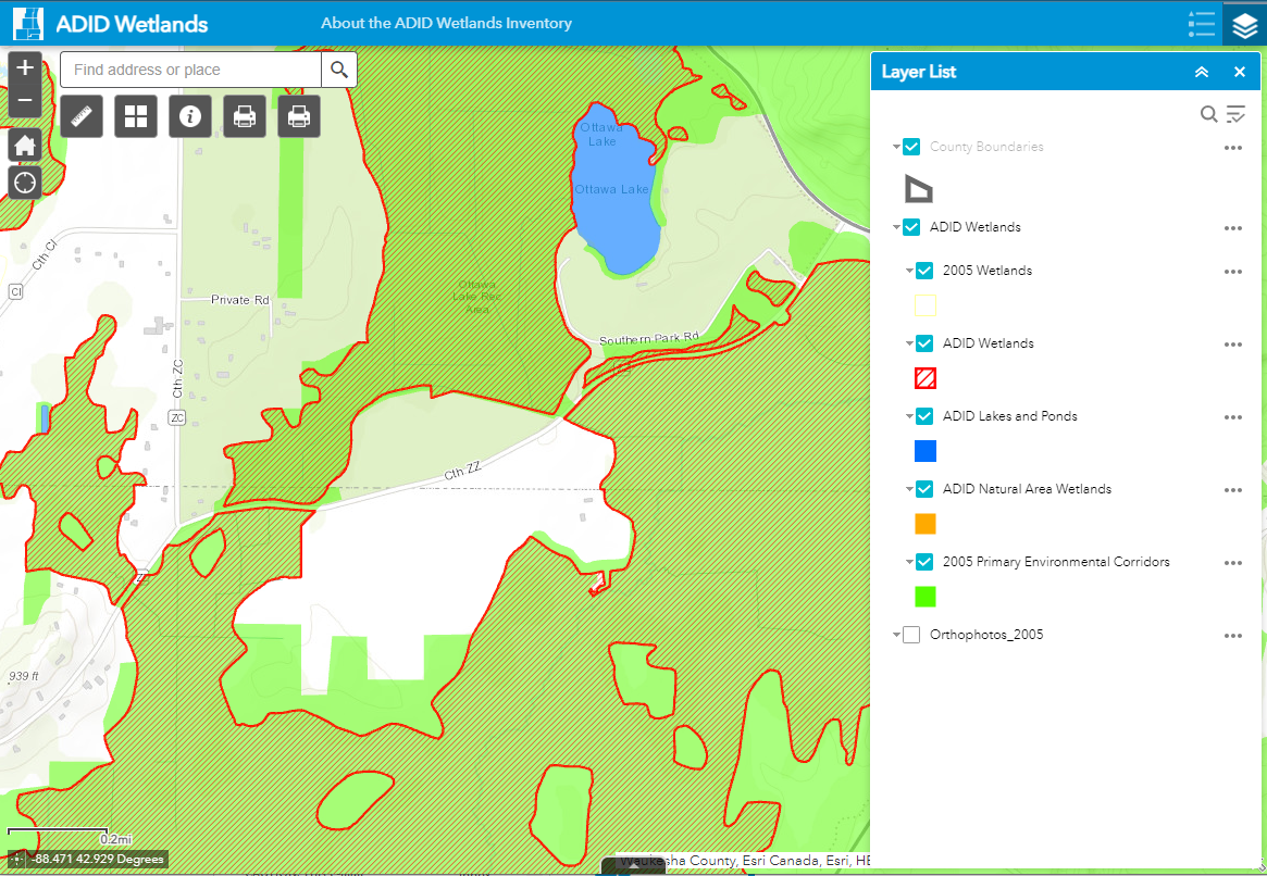
ADID wetlands can also be viewed in the ADID Wetland Viewer, a mapping tool that displays 2005 ADID wetlands, primary environmental corridors, and color orthophotography.
ADID Wetlands
The Commission provides technical assistance to federal and State agencies in preparing maps of wetland areas deemed inappropriate for the disposal of fill and dredged materials.
Advanced Identification of Wetland Disposal Areas (ADID)
Under federal law, Federal and State regulatory agencies are empowered to identify, in advance, those wetland areas they collectively determine to be inappropriate for the disposal of fill and dredged materials. These determinations are made jointly in Southeastern Wisconsin by the U.S. Department of the Army, Corps of Engineers, the U.S. Environmental Protection Agency, and the Wisconsin Department of Natural Resources. The Commission provides technical assistance to these agencies in preparing these useful maps.
Maps showing the areal extent of ADID wetlands in Southeastern Wisconsin are available in PDF format for each county: